Innovative community-focused information sharing and mapping techniques have literally exploded in the last years. These tools have the power to revolutionize how we think about solutions to global health challenges. For example, a recent UNOCHA report outlines how novel information sharing approaches that build on the strength of communities have the potential to radically reshape responses to disasters, health emergencies and other challenges.
In our work at FSG, understanding the impact of these tools in solving social problems is key to understanding how the organizations we work with can support these efforts to ultimately achieve social impact. The work of the Knight Foundation Community Information Challenge, for example, is inspiring communities around the US to think of how local information drives community health.
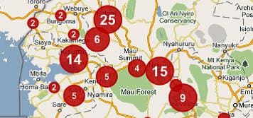
Crowdsourcing in Kenya
In environments where access to official information is patchy at best, tools that efficiently collect diffuse information and transform it into a complete picture can be invaluable. Ushahidii, an organization based in Kenya, uses messages sent from cellphones to track events such as violence and unrest and send updates to vulnerable populations that are spread over large areas with limited access to the internet. The Ushahidi platform also uses this crowdsourced information, sometimes in combination with data from other sources, to visualize trends over time and space and facilitate early response to provide near instant information to local communities.
Ushahidi started as an early warning system after the unrest following Kenya’s election in 2008, with over 48,000 people using the website to understand threats of violence in their communities. Since then, the platform has been further developed and used to monitor elections in Lebanon and Afghanistan and to monitor medicine shortages in the Philippines.
This tool is a prime example of how communities can capitalize on the combination of crowdsourcing and open mapping to respond to threats of violence and lack of medical supplies. Do you know of other examples? If so, please tell us about them!
Community mapping in Haiti
After the 2010 earthquake in Haiti, OpenStreetMap became a key tool for collating spatial data and building an up-to-date map of Port-au-Prince. In this effort, the platform drew on data provided by 640 volunteers from around the world. This meant that a blank spot on the map became one of the most accurately mapped areas in the world, in record time and with only limited cost. OpenStreetMap has since expanded into a tool used by the UN and other large humanitarian actors.
A key strength of the maps created using OpenStreetMap is that they can respond to real time information needs of communities. After news broke of a cholera outbreak in Haiti following the earthquake, 200 schools in the Cite Soleil area were quickly identified and assessed for suitability as cholera treatment centers. This happened within a matter of hours. Similarly, over 100 IDP camps were mapped to provide information on the location and availability of wells and latrines along with pathways to these services.
To achieve greater social impact, the Humanitarian OpenStreetMap team (HOT) has been formed to build the capacity of local actors to take ownership of the mapping process. In contrast to GIS, which requires training and a software license, OpenStreetMap requires only a simple web browser and is easy to learn. This increases the ability of local actors to inform the maps produced and enhances the relevance of the products to those in need. This tool is a prime example of how communities are empowered by access to spatial data and open mapping, allowing them to maximize the use of already existing resources and target external assistance. Do you know of other examples? If so, please tell us about them!
Balloon/Kite mapping in Lima and Chile
Balloon/Kite mapping is a community engagement tool developed by the Public Laboratory for Open Technology and Science. Satellite-style images are captured by strapping a camera to a strong kite or set of balloons, and the entire kit typically costs less than $100. This low cost tool enables communities to:
- Create satellite-style, high resolution, hyper-local maps in areas where satellite maps are not of high quality or out of date
- Map different aspects of communities over time to track changes in community conditions
This approach to mapping has been used to track health hazards resulting from water pollution, track oil spills in the Gulf of Mexico, and document peaceful protests in Peru. A recent project involved mapping access to, and quality of, public sanitation in Villa Maria, an informal settlement in Lima, Peru. With new maps of areas that were previously off the radar of government officials, the community is able to clearly illustrate their lack of basic services.
This tool is prime example of how communities benefit from cheap and simple tools that allow them to create powerful maps of threats to their communities. Do you know of other examples? If so, please tell us about them!
What can we learn?
The organizations described have a few key aspects in common in terms of how they have developed and scaled-up their impact. They have taken some or all of the following steps:
- Identified a common problem faced by a vulnerable and underserved population
- Innovated through experimentation
- Trained community members
- Used a coordination cell / backbone organization for synthesis, management and response
- Integrated new tools into formal policy and strategies
- Evaluated their results and continuously refined their approaches with community input
Individuals and organizations around the world are realizing the potential of these tools, especially as we continue to emphasize the power of local communities and informal actors in responding to urgent health and development challenges. When creating strategies for real, tangible change, the ability to visualize large volumes of information and draw on the people who are facing challenges on the ground is key. These grassroots mapping tools are allowing communities themselves to create strategies based on up to date, local information. These tools will also allow us, and the organizations we work with, to better map out how to fill the gap between what communities can solve on their own, and where the global community can step in.